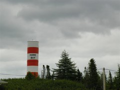
The first notable place name that I came to was Hare Bay, one of the many communities in Newfoundland named after the animals on which the settlers depended.
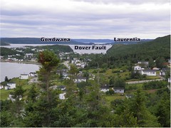
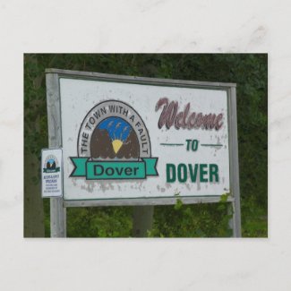
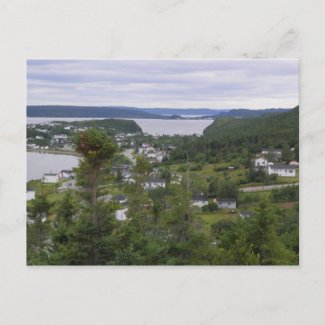
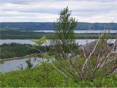
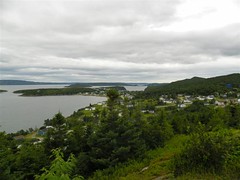
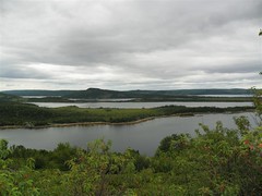
Closely attached to Hare Bay is the town of Dover - “the town with a fault“. Dover is the point where two former continents, Gondwana & Laurentia, collided hundreds of millions of years ago to form a new continent. The pressure of the collision created the Appalacian Mountain range, and a fracture in the earth, or fault, appeared as a result of the strain. This fault can be seen from a lookout at the top of the town. Later, the continent broke apart again just east of the island, leaving a portion of the Gondwana continent attached to form the eastern part of Newfoundland.
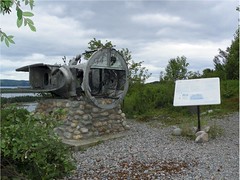
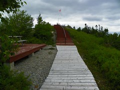
About halfway up the trail is a monument to the crash of the RCAF Digby, a B-18 bomber, that crashed just north of the town of Dover in 1942. Fortunately, the pilot and crew members escaped serious injury, but the plane was destroyed.
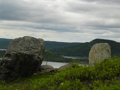
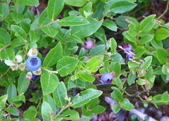
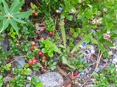
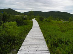
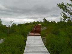
There is a small information centre and gift store at the base of the trail, and you can walk from there to the beginning of the trail (just a few hundred feet behind the building) or drive to the parking lot before starting on the trail. The trail itself is all boardwalk with a few sets of stairs along the way - not long, and an easy walk, although it is uphill. The trail is bordered by natural Newfoundland plant life, including some popular berries.

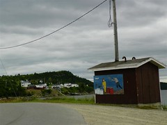
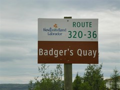
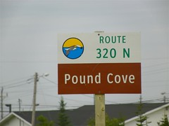
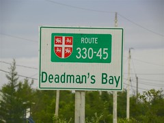
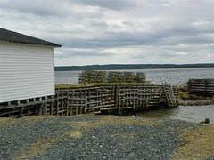
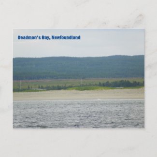
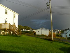
So after a pleasant walk and visit at the top of the hill, it was back on the road. First I drove around the town of Dover and was impressed by the paintings on various buildings throughout the town. Then, after driving through towns with names like Badger’s Quay and Pound Cove, I stopped for lunch at a town with a very interesting name - Deadman’s Bay. I haven’t yet been able to determine how that particular name came about, but I did find an online article about a women who encountered none other than a polar bear near there on her way to work one morning. It was a picturesque community with a long, long sandy beach and a rustic dock which I sat overlooking as I ate. I watched a seagull leave the dock and suddenly dive into the water, then take off with its prize, only to be chased by another, larger, bird. I guess it eluded having its catch taken, however, because it soon came back to the dock where it ate the tasty morsel, and then flew off again. Thankfully, however, I saw no sign of polar bears.
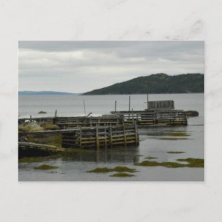
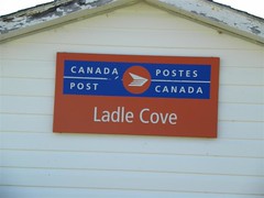
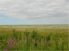
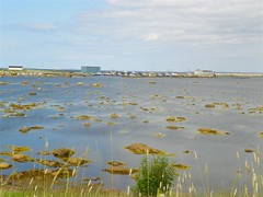
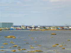
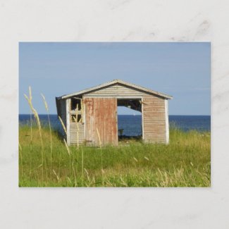
The next unique place I stopped was Ladle Cove. The name brings up images of wooden pails by the door filled with water and a ladle for filling your cup on a hot day. I was struck by the amount of sand in this area - on beaches, along roads, and even vast expanses mixed in amongst the grass on the banks throughout the towns. The small harbour in the town reminded me of why we call this place “The Rock,” as it was dotted with small rocks a long way out into the water. I was also thrilled to happen along an old shack with both doors gone, offering the perfect frame for a sailboat out on the water behind it.
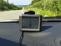
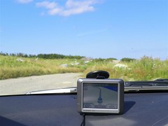
Up to now I haven’t really mentioned my traveling companion, “Gia” - better known to most as a GPS. She’s great company - always there helping me along, but quiet - only speaking up as needed. She was good at finding most of the major places for me, but she didn’t know a lot of the smaller communities. So I would program her for a major destination, and use her to keep track of the time of arrival to see if I was running late or had more time to explore. So whenever I’d go off route to see one of the other places, she would get somewhat confused. Normally she’d gamely pick another route to get me back on the right road or tell me to make a u-turn if she couldn‘t find another route, adjust the arrival time, and patiently wait for me to turn back. However, there were times that I could almost imagine frustration in the modulated voice. In particular, I caused her some concern on this day. She had tried several times to suggest places for a u-turn, and finally gave up. I figured she was trying to tell me I was on my own when she suggested I continue to the highway along a dirt walking path.
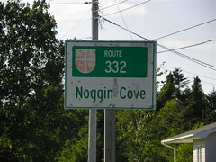
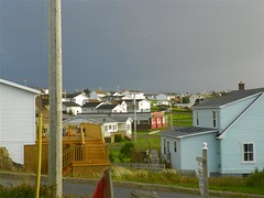
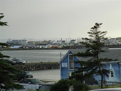
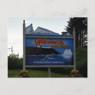
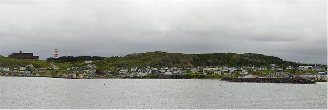
To make Gia happy, I got back on route, and drove through Noggin Cove before turning off at Gander Bay South for the road to Twillingate, finally arriving at the Echoes of the Ocean B&B as the sun and cloud gave way to showers - with a drenching rain falling even as the sun continued to shine brightly. It made for a picturesque sight overlooking the boat tours at the bottom of the street and the houses of the town.
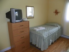
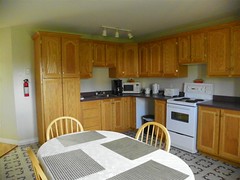
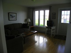
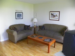
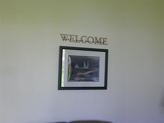
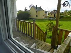
The Echoes of the Ocean B&B was a pleasant surprise. Not what you’d expect from a B&B, it was actually a pair of small self-contained units separate from the owners’ house (which was just behind it). Each unit had two bedrooms (which were rented separately) with a shared living room and kitchen with full access to the fridge, stove, kettle, coffee pot, and microwave and coffee and tea were provided for use at any time. Each bedroom had its own bathroom. Mine was a nice size with a full vanity and bathtub, but I got the impression the other had a small shower stall. The room contained a TV on a dresser, a fairly big closet, and a queen-size bed, as well as a separate twin cot, which would make it a great location for a small family or group traveling together. In fact, the price to rent the entire unit with both bedrooms was fairly reasonable at just $150 a night. The only real drawback was that the internet was sketchy, and I couldn’t even get connected at all the first night. Once I got connected, the speed was very low, but it did at least stay connected for the second night, and it was moderately better in the kitchen the following morning. Breakfast was self-serve, and baskets of homemade breads and muffins and dishes of preserves were laid out and the table set the night before. There were also a selection of cereals available and a few varieties of milk to choose from.


I stayed in Twillingate for two nights, using it as a base for exploring the area, but that’s another story. . . .
No comments:
Post a Comment
Please share your comments on this post or your interest in Newfoundland